Safety, Weather and Leave No Trace
Basic Navigation for Campers: Maps and Landmarks
How to use official park maps, landmarks, a topographic map and offline maps so you can find your way around camp.
On this page
Campground loops look alike. Pine trees look alike. After dark, a short walk to the restroom can feel longer than it is, and your phone may show no signal at all. Navigation sounds like a hiking skill, but campers use it every day: finding the right site, the water spigot, the trailhead and the way back.
This article covers the basics. You will learn which maps to get, how to pick landmarks before you need them, how to read the main parts of a topographic map, and how to prepare a phone map for places without signal. It does not teach rescue skills or what to do if you are lost. NPS covers that on its Outdoor Emergency Plan page, which is listed under sources.
You do not need special gear to start. A paper map and a little attention go a long way.
Start with the maps the campground and park give you
Begin with the park map and the campground map. The campground map guide explains loops, site numbers and facilities. The National Park Service (NPS) also offers a catalog of more than 1,000 maps you can download or print, searchable by state or park.
Do not rely on your phone alone. NPS says in its Trip Planning Guide to always carry a backup paper map, because your phone battery may not last the whole trip and you could damage or lose the phone.
Park pages often tell you how maps work locally. Great Smoky Mountains National Park, for example, warns that popular online maps and GPS apps may give wrong directions in the mountains, sending visitors the wrong way down one-way roads or to dead ends. Cell coverage there is very limited, so the park recommends a free brochure map from a visitor center or a download before you start. That is one park, but the lesson applies broadly. Look for a “Maps” page on the website of the place you are visiting and save what it offers while you still have signal.
Pick landmarks before you need them
NPS suggests reviewing the map and your planned route and noting landmarks you can use as reference points. While you move, pay attention to trail junctions, information signs and landmarks, and check that you are still on your route.
At a campground, good landmarks are easy to find:
- Your site number and the loop sign nearest to it
- The restroom building and the water spigot
- The campground host site or the kiosk
- The nearest trailhead or the road out
- A meeting spot everyone in your group can find on the map
Do this walk in daylight. NPS advises making camp before dark and learning the terrain during the day. If you must leave camp after dark, stay in areas you saw in daylight, go with a companion, and use a headlamp. The camp lighting guide covers lights. If you are walking beyond the campground, tell someone your route first. Tell someone your plan shows how.
Reading a topographic map
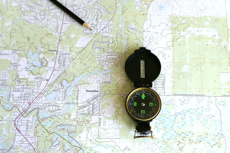
A topographic map shows the shape of the land. The U.S. Geological Survey (USGS) says its defining feature is contour lines, which are imaginary lines connecting points with the same elevation. USGS maps also show roads, rivers, lakes, boundaries and place names.
| Map feature | What it shows | How to use it |
|---|---|---|
| Brown contour lines | Shape and elevation of the land | Lines close together mean steep ground. Lines far apart mean flatter ground |
| Contour interval | The set difference in elevation between neighboring lines, printed in the map margin | Read it first, so the numbers mean something |
| Index contours | Heavier brown lines, usually labeled with the height in feet or meters | Use them to estimate elevation |
| Blue lines and areas | Streams and water | Find your water source and low ground |
| Green tint | Woodland | See where trees block the view |
| Scale bar and ratio | Map distance compared with ground distance | On a 1:24,000 map, 1 inch equals 2,000 feet |
| Legend | The meaning of each symbol | Check it before you trust a symbol |
The USGS sheets in the sources list work as a free practice lesson. Try the “Activity Sheet #4” at home before the trip. It asks you to find the steeper hill and the gentler path up it.
Compass and phone maps, in plain terms
NPS lists navigation among the 10 Essentials, with a map, compass and GPS system. Its advice is practical: know how to use them before you go out, carry a physical map as a backup, and pack an extra battery for your phone. Practice at home or in the backyard, not for the first time in the woods.
Two compass facts from USGS help beginners:
- A compass needle points to magnetic north, which is not the same as true north. A diagram in the map margin shows the difference, called declination. USGS adds that the value printed on a map may not be current.
- Iron and steel objects affect compass readings. Stay away from knives, belt buckles, trucks and power lines when you take a reading.
For phone maps, save the area before you leave home. Many parks publish a map file or an official app with a download option. Pictured Rocks National Lakeshore, for example, asks visitors to save its brochure map to a phone before arrival because many places in the park have no cell service. Open the saved file once at home to make sure it works without a signal.
Common mistakes
- Trusting a phone with no backup. Batteries die and phones break.
- Using a general map app in a remote area. Park pages warn that these can give wrong routes.
- Learning the map after dark. Walk the campground in daylight.
- Skipping the contour interval. Without it, the elevation numbers mean nothing.
- Forgetting the group. Pick a meeting spot together and make sure everyone can find it on the map.
- Carrying a compass next to metal. Keep it away from knives, buckles and vehicles when you read it.
Frequently asked questions
Do you need a compass to camp in a campground?
Not for a typical drive-up campground with signs and a map. If you plan to hike beyond it, NPS lists a map, compass and GPS system among the 10 Essentials and says to learn how to use them first.
What is the best map for a first camping trip?
Start with the official park map and the campground map. Add a topographic map if you plan to walk off the main trails. Ask a ranger or check the park’s “Maps” page.
What does 1:24,000 mean on a map?
It is a scale. One unit on the map equals 24,000 of the same unit on the ground. USGS says that on this common series, one inch equals 2,000 feet.
Can you rely on a phone map?
Use it as one tool, not the only one. NPS recommends a paper backup and a spare battery, and many parks warn about weak signal.
Next step: build your navigation kit
Add three items to your checklist in the Planner: the park and campground maps, a saved offline map file, and a landmark list for your campsite. Do the landmark walk when you arrive, in daylight.
Sources
Official pages used for this guide. Rules vary by place and change often, so check the page for your campground before you go.
- The 10 Essentials, National Park Service. Accessed November 6, 2026.
- Outdoor Emergency Plan, National Park Service. Accessed November 6, 2026.
- Trip Planning Guide, National Park Service. Accessed November 6, 2026.
- Find a National Park Service Map, National Park Service. Accessed November 6, 2026.
- Maps, Great Smoky Mountains National Park (example), National Park Service. Accessed November 6, 2026.
- Maps, Pictured Rocks National Lakeshore (example), National Park Service. Accessed November 6, 2026.
- Finding and Setting Up a Campsite, National Park Service. Accessed November 6, 2026.
- What is a topographic map?, U.S. Geological Survey. Accessed November 6, 2026.
- Activity Sheet #4: How to Read a Topographic Map, U.S. Geological Survey. Accessed November 6, 2026.
- Finding Your Way with Map and Compass (Fact Sheet 079-99), U.S. Geological Survey. Accessed November 6, 2026.
Keep reading
Safety, Weather and Leave No Trace
Quiet Hours and Campground Respect
Where to find your campground's quiet hours, what counts as noise, and simple habits that keep neighbors comfortable.
Safety, Weather and Leave No Trace
Tell Someone Your Plan: A Simple Trip Itinerary
A one-page trip plan for a trusted contact: what to write, who should hold it, and what they do if you are not back on time.

Safety, Weather and Leave No Trace
Camping With Kids: Planning for Comfort and Safety
Plan a family camping trip with comfort and safety in mind, using National Park Service pages for kids and campers.